


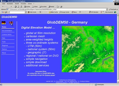
GlobDEM50
Digital Elevation Model on cartesian 50m Meshes
GlobDEM50 - high resolution digital elevation data (DEM), accessible within an easy-to-use web application.
Advantages of GlobDEM50 at a glance:
- all elevation data given in three reference systems:
- geographic mesh at 3” resolution
- cartesian UTM mesh at 50m resolution
- cartesian national system at 50m resolution
(e.g.. Gauß-Krueger for Germany,
British National Grid for UK, etc.) - real area-weighted heights
- regional / national editions on DVD
- all data in ASCII Arc Grid Format
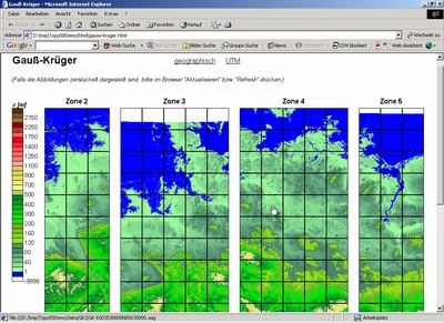
- easy navigation and download from DVD by use of hot spots in elevation contour plots
GlobDEM50 data are supllied in regional editions on DVD. The first editions are available since September 2004: Germany, Austria/Switzerland, Poland, and Czechia/Slovakia. Additional regional editions are in preparation and will be continued. You can find an updated list of available regions here:
List of available GlobDEM50-Regions
GlobDEM50 is based on raw data from the Shuttle Radar Topography M ission, a joined project of NASA, NIMA, DLR und ASI in the year 2000. SRTM data have been post-processed by us:
- filling of data voids by several processes
- area-weighted interpolation from geographi mesh (LonLat auf WGS84) to international cartesian mesh (UTM / WGS84) and national cartesian systems (different co-ordinate systems / reference systems)
- format conversion to ASCII Arc Grid
Try GlobDEM50 now:
Internet version for fast DSL connection
Download for slow ISDN or modem (9Mb)
(Please extract zip file including pathes on your hard disc!)
The GlobDEM50 internet version is fully functional. However, only one ASCII Arc Grid data file is accessible (tile “Harz”, Gauß-Krueger-Co-ordinates, zone 3, red marked tile) and tools can not be downloaded.
Loading of pages with plots (as in the example below) may take a long time in the internet version! However, the DVD-Version is fast!
Important note:
GlobDEM50 data are mean heights over areas of one grid cell. They are calculated from area-weighted interpolation! That means heights are really with respect to the cartesian meshes. In contrast to GlobDEM50 data you can easily find other data sets or procedures where point co-ordinates (central mesh points) are simply transformed from the geographic mesh to other co-ordinate or reference systems. With this simple procedure the height data are no longer related to the corresponding grid cell areas within the new mesh!
Further details can be found in the documentation of the GlobDEM50 demo version.